 |
||||
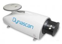
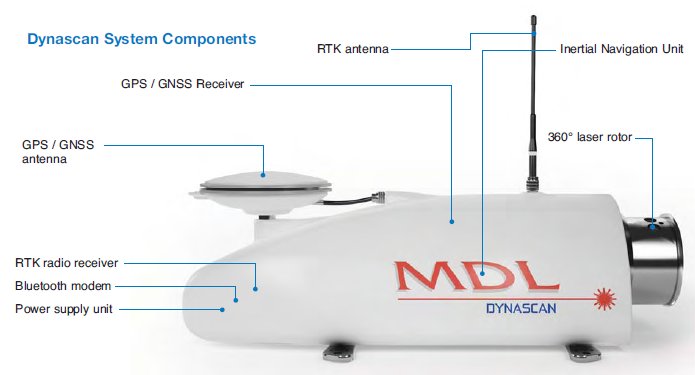
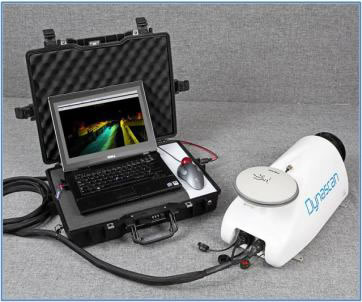
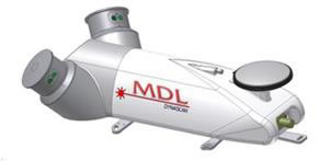
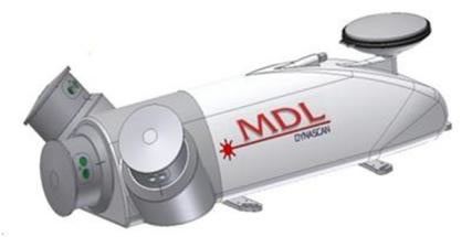
| The Dynascan "Plug and Play" LIDAR system is a fully integrated high speed laser scanner, high accuracy GPS positioning system and Inertial Measurement Unit. Options are available to the Dynascan system depending upon the user's requirement or application. The system uses a variety of sensors to suit the particular needs of the survey being performed. For example, GPS heading sensor with separate pitch & roll sensor or GPS / INS sensor combined. The package is flexible and can either be contained in one small pod where space is at a premium, or supplied with two separate GPS antennas as an option to provide heading information. |
||||
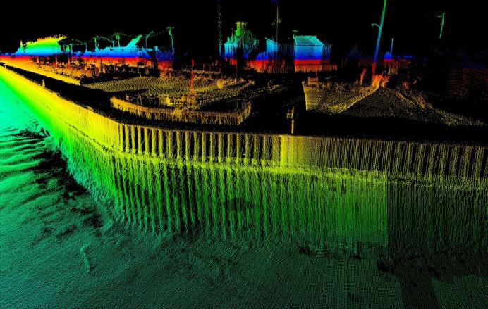
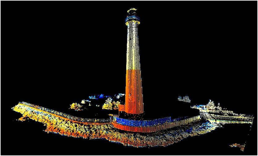
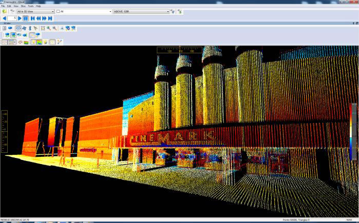
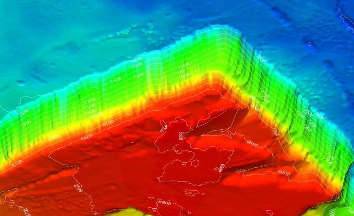
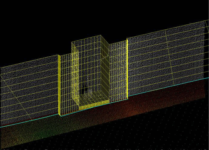
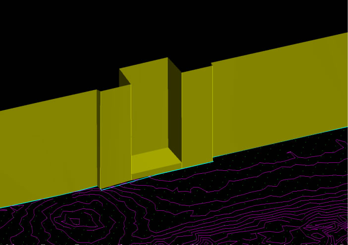
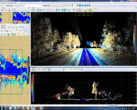
Examples of Dynascan System Data |
||||
 |
 |
 |
||
Laser and Multi-Beam Echo Sounder Data |
Laser and Multi-Beam Echo Sounder Data |
Shoreline Surveys |
||
 |
 |
 |
||
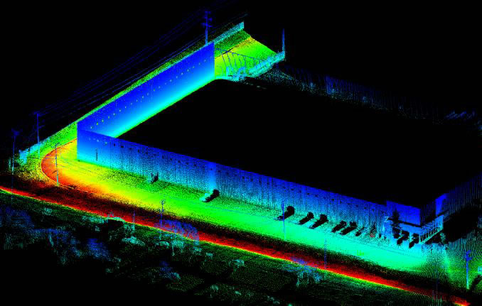
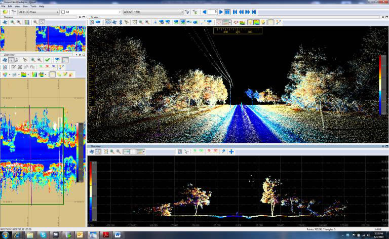
Mobile Mapping |
Mobile Mapping |
Mobile Mapping |
||
 |
 |
 |
||
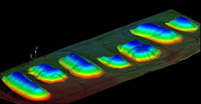
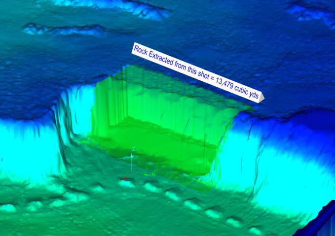
Stockpile Surveys |
Volume Calculations |
Contour Mapping |
||
 |
 |
 |
||
Inventory Management |
Feature Extraction |
Feature Extraction |
||
 |
Dynascan Technical Specifications |
|||
| Laser Scanner: • Class 1 (FDA/ IEC) (Class 2 with red dot pointer) • Range up to 500m (1640') • Accuracy: ± 5 cm (2.0") • Range resolution: 1 cm (0.4") • Scanner field of view: 360˚ • Scanner angle resolution: 0.01˚ • Scan rate: up to 30 Hz (1800 rpm) • Pulse Measurement rate: 36 KHz • Number of scanners per system: up to 10 |
Power and Dimensions: • Power: 12 to 17 volts DC 30W • Weight: 11 kgs (25 lbs) • Size: L595mm x W240mm x H255mm (L23" x W9.5" x H 10") |
||
| Attitude Accuracy: • Azimuth: 0.1 • Roll: 0.05˚ • Pitch: 0.05 |
|||
| Environmental: | Horizontal Position Accuracy (RMS): | ||
• Operating temperature: -20˚C to +60˚C (-4˚F to 140˚F • Storage temperature: -20˚C to 70˚C (-4˚F to 158˚F) • Water and dust resistant to IP 65 |
• Choice of GNSS receivers • RTK accuracy up to 1cm (horizontal) • Options to take corrections from various sources |
||
Dynascan Software |
||
Dynascan Software Key Features: |
 |
|
| • Software runs on a Single Rugged Laptop Computer • Interfaces in "Real-Time" to multiple sensors and systems • Fully Synchronized in Real Time to the Data Collection • Real Time Quality Control to "User Definable Parameters" • Real Time 3D visualization • Integral System Calibration Utilities • Real Time Processing of large volumes of 3D Data • Automatic Data Filtering and Cleaning • Automatic generation of Cross Profiles or Contours • Volume Calculations • Professional Training and 24/7 Support • Multiple "Industry Standard" Data Exchange Formats |
||
Dynascan Packages |
||||
Single Scanning Laser Dynascan System with Integrated GPS & IMU |
||||
 |
Single Laser Dynascan Pod c/w • Single MDL Scanning Laser Module – 36 kHz Data Points / 1200 RPM • Combined Dual Frequency GPS and IMU system • Integrated GPS & Satellite DGPS Antenna • Integrated RTK Radio Receiver • Rugged Laptop PC • Data Acquisition Software & Security Dongle • Offline Data Processing Software • Rugged Transit Case • 12 Months Factory Warranty |
|||
This system is available with a 150 Meter or 500 Meter Laser Range Capability |
||||
| For pricing, please contact MosaicGeo at sales@mosaicgeo.com | ||||
Single Scanning Laser Dynascan System with Integrated GPS/GLONASS, High Grade IMU & Dual GPS Antenna Heading System |
||||
|
Single Laser Dynascan Pod c/w • Single MDL Scanning Laser Module - 36 kHz Data Points / 1200 RPM • Fully Integrated GPS/GLONASS Receiver • High Grade IMU System • Dual GPS Antenna Heading System • Rugged Laptop PC • Data acquisition software & Security Dongle • Offline Data Processing Software • Rugged Transit Case • 12 Months Factory Warranty |
|||
| This system is available with a 150 Meter or 500 Meter Laser Range Capability | ||||
| For pricing, please contact MosaicGeo at sales@mosaicgeo.com | ||||
Dual Scanning Laser Dynascan System with Integrated GPS/GLONASS, High Grade IMU & Dual GPS Antenna Heading System |
||||
 |
Dual Laser Dynascan Pod c/w • Dual MDL Scanning Laser Modules - 72 kHz Data Points / 2400 RPM • Fully Integrated GPS/GLONASS Receiver • High Grade IMU System • Dual GPS Antenna Heading System • Rugged Laptop PC • Data acquisition software & Security Dongle • Offline Data Processing Software • Rugged Transit Case • 12 Months Factory Warranty |
|||
| This system is available with a 150 Meter Laser Range Capability | ||||
| For pricing, please contact MosaicGeo at sales@mosaicgeo.com | ||||
Triple Scanning Laser Dynascan System with Integrated GPS/GLONASS, High Grade IMU & Dual GPS Antenna Heading System |
||||
 |
Triple Laser Dynascan Pod c/w • Triple MDL Scanning Laser Modules - 108 kHz Data Points / 3600 RPM • Fully Integrated GPS/GLONASS Receiver • High Grade IMU System • Dual GPS Antenna Heading System • Rugged Laptop PC • Data acquisition software & Security Dongle • Offline Data Processing Software • Rugged Transit Case • 12 Months Factory Warranty |
|||
| This system is available with a 150 Meter Laser Range Capability | ||||
| For pricing, please contact MosaicGeo at sales@mosaicgeo.com | ||||
